About Me

Alex Rojas, M.S.
Geospatial Data Analyst
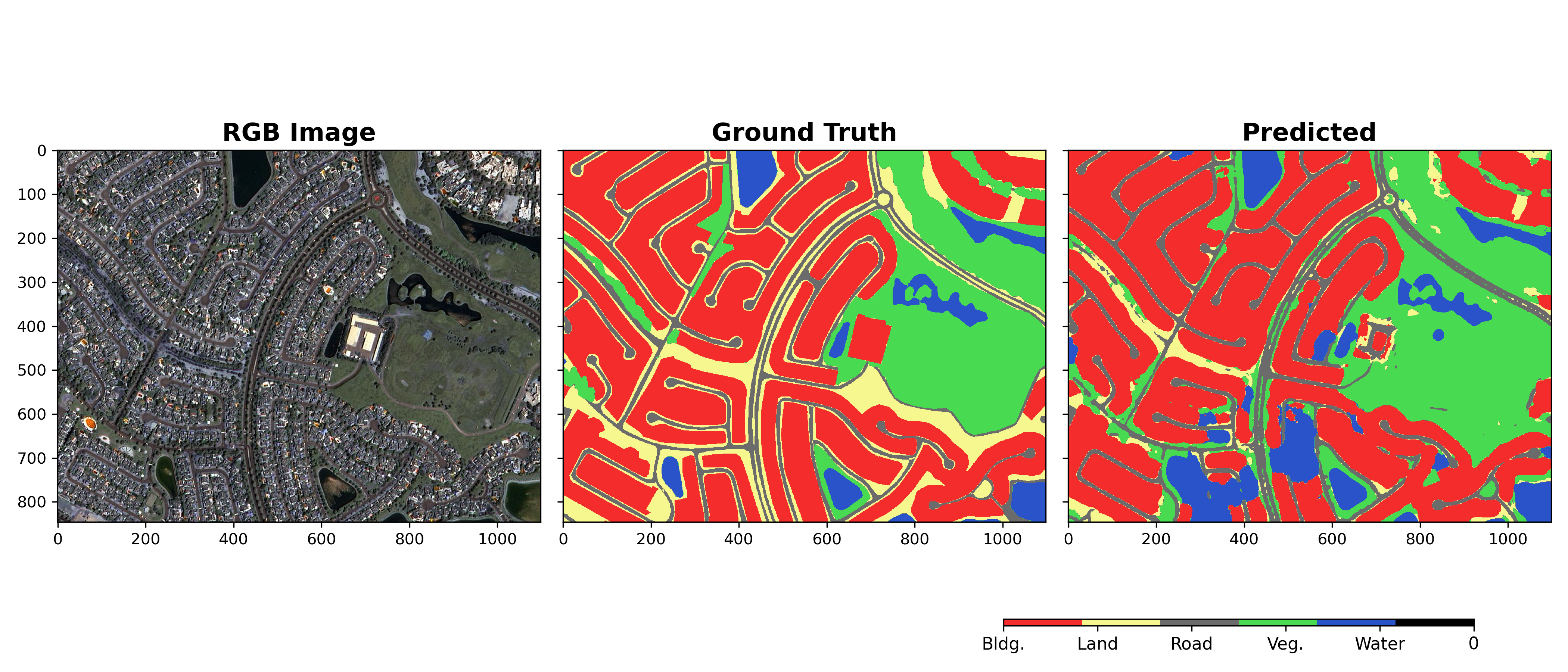
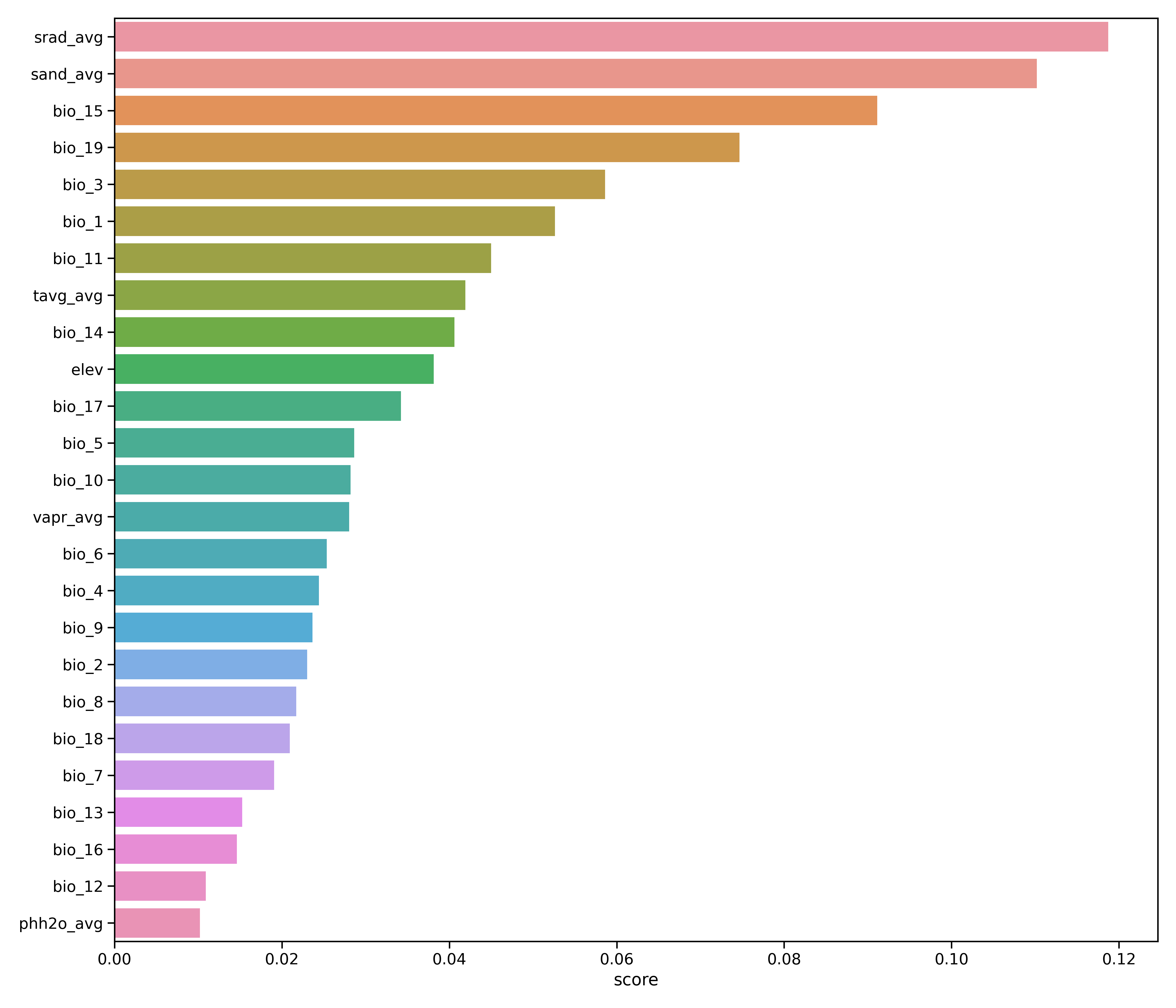
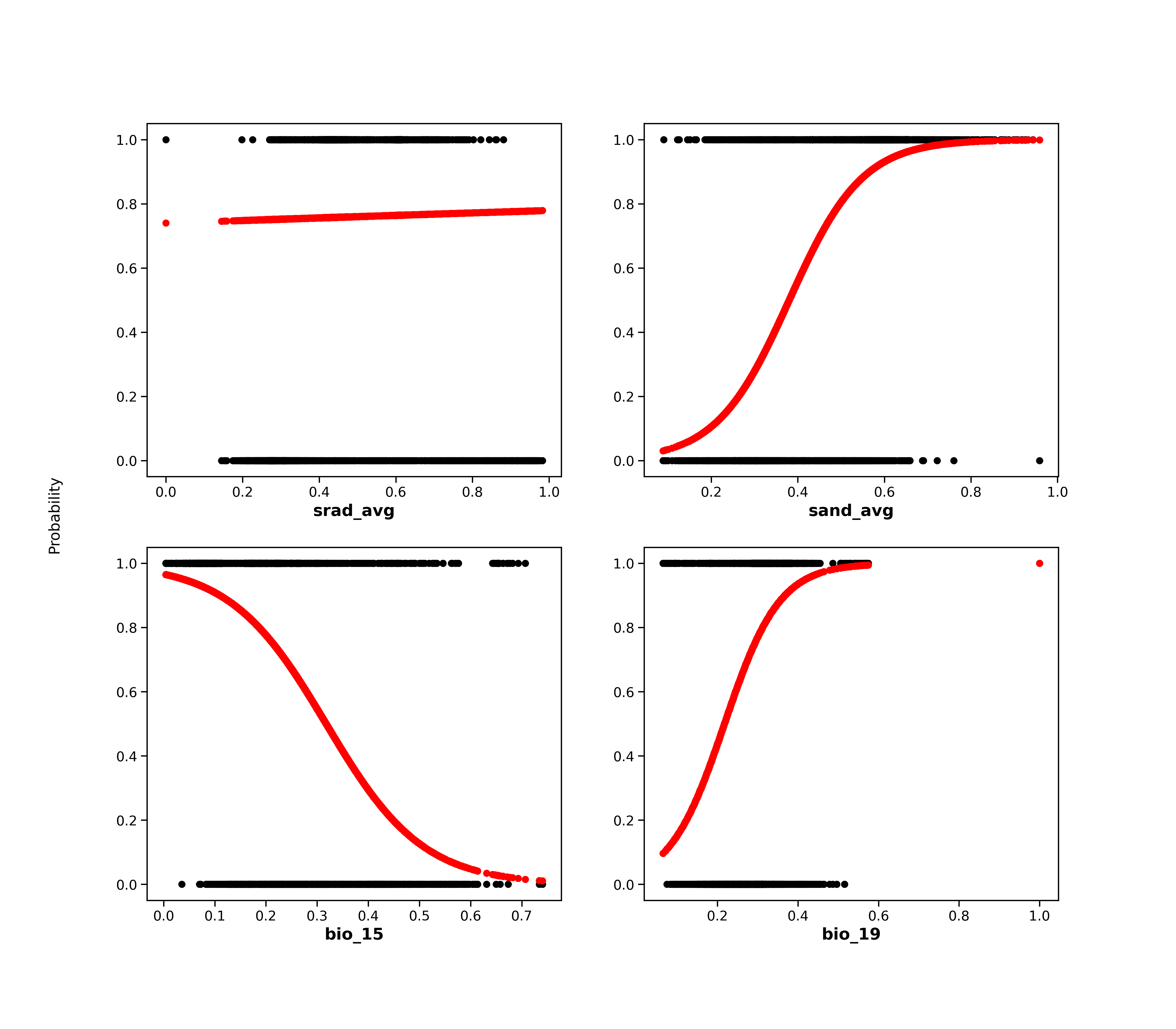
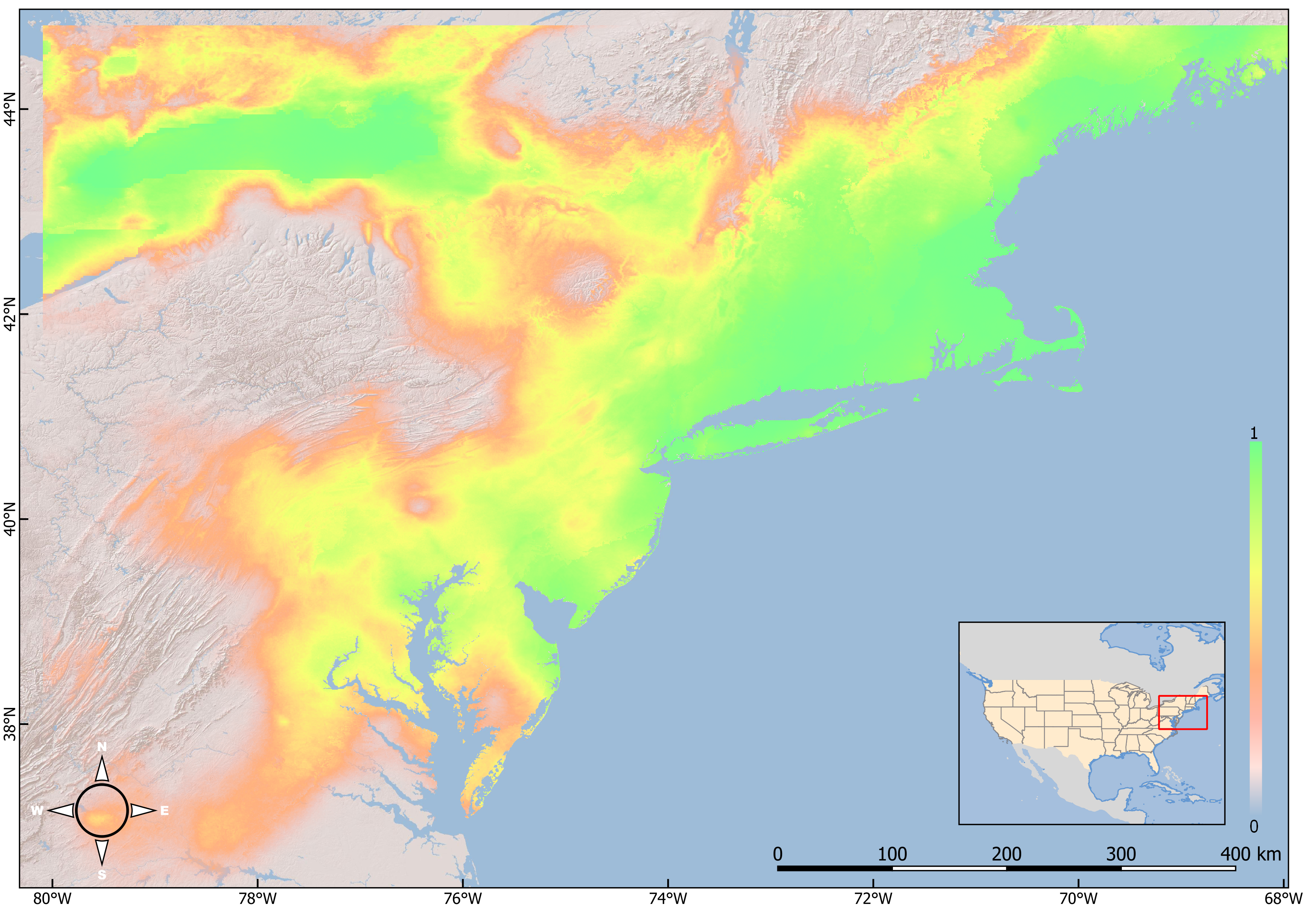
I am a geospatial data analyst specializing in remote sensing
applications. My research interests include Geographic Information
Science (GIS), remote sensing, and environmental modeling. More
specifically, I am interested in applying geospatial big data and
machine learning to study environmental change, especially forest
and wetland dynamics.
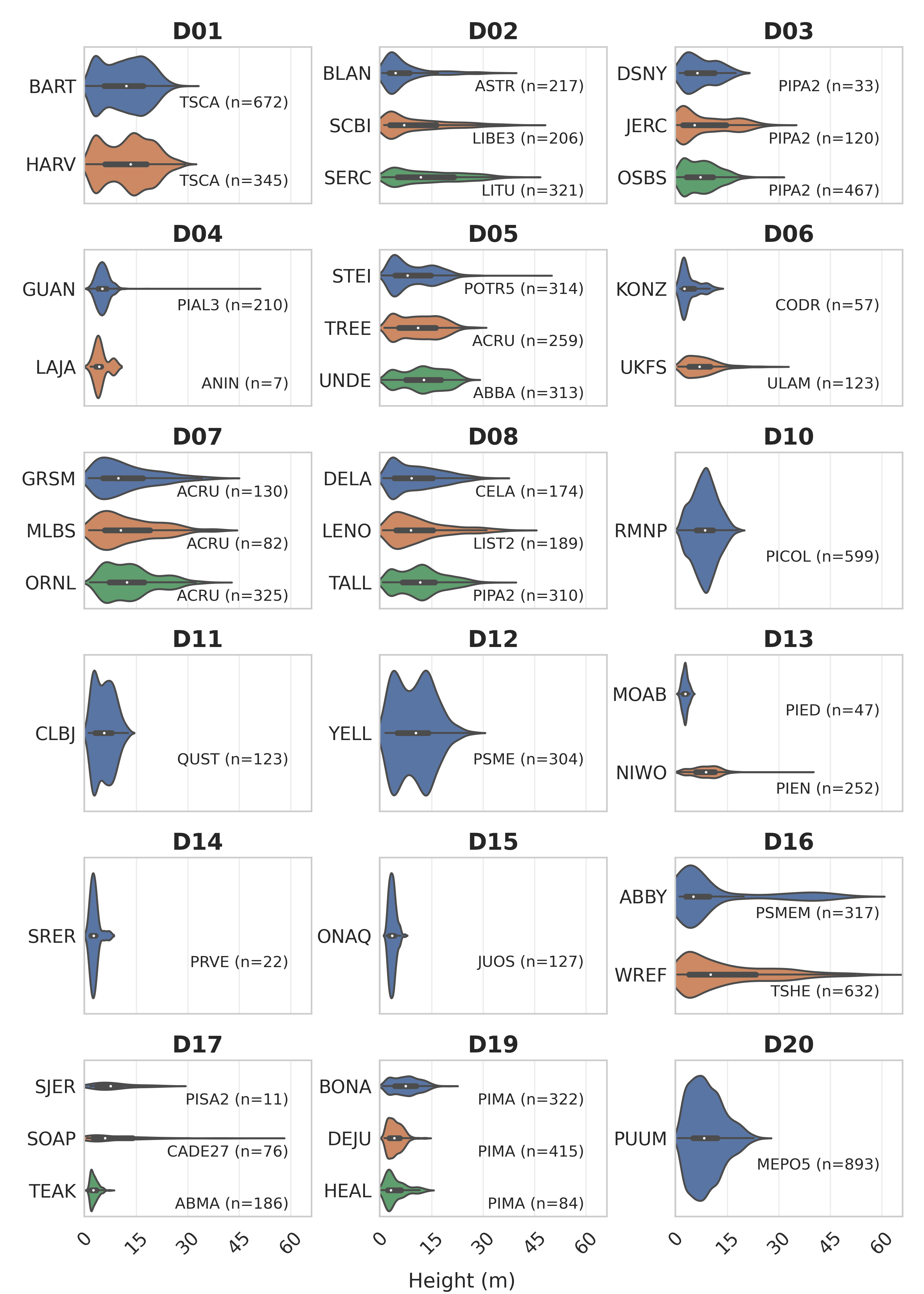
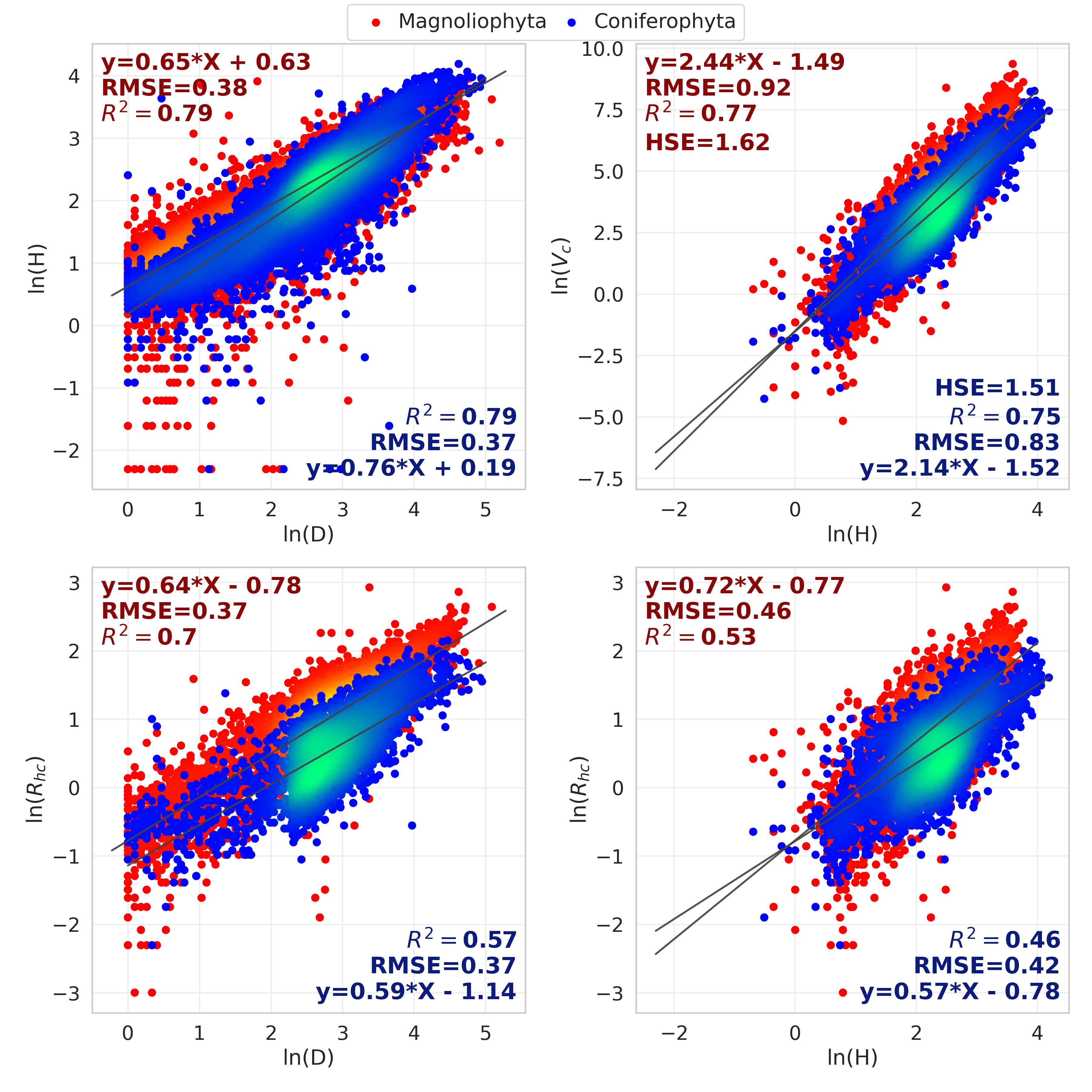
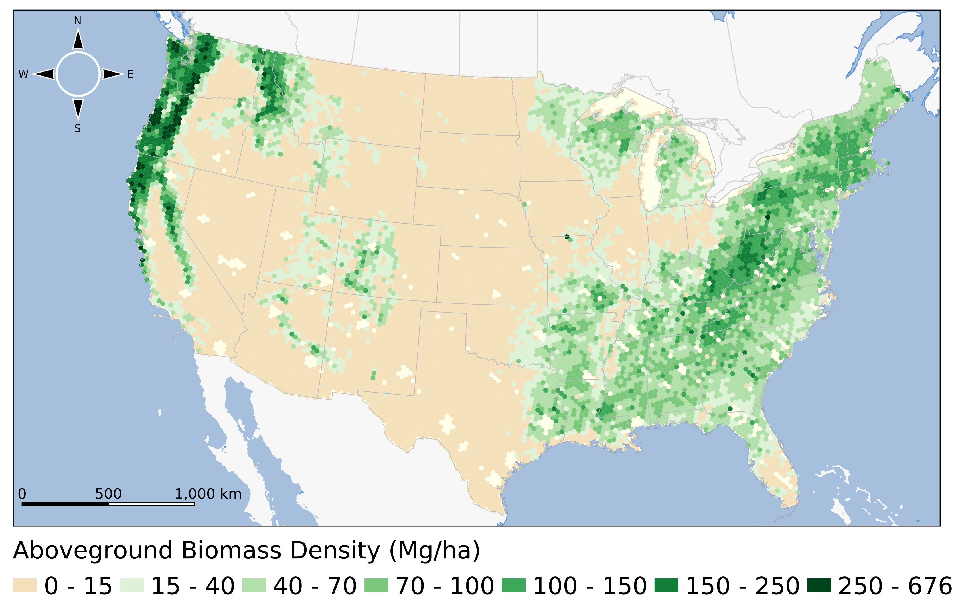
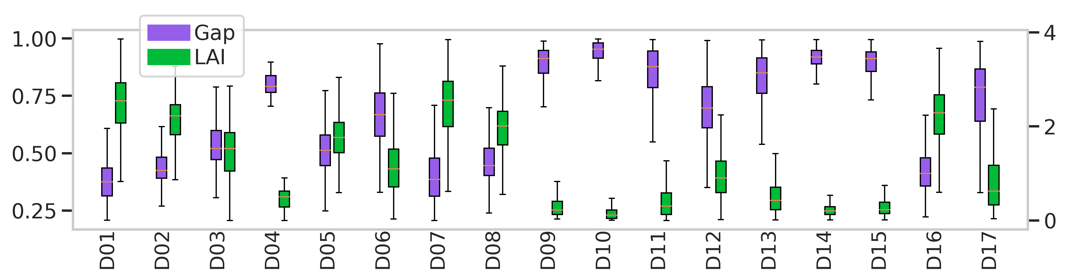
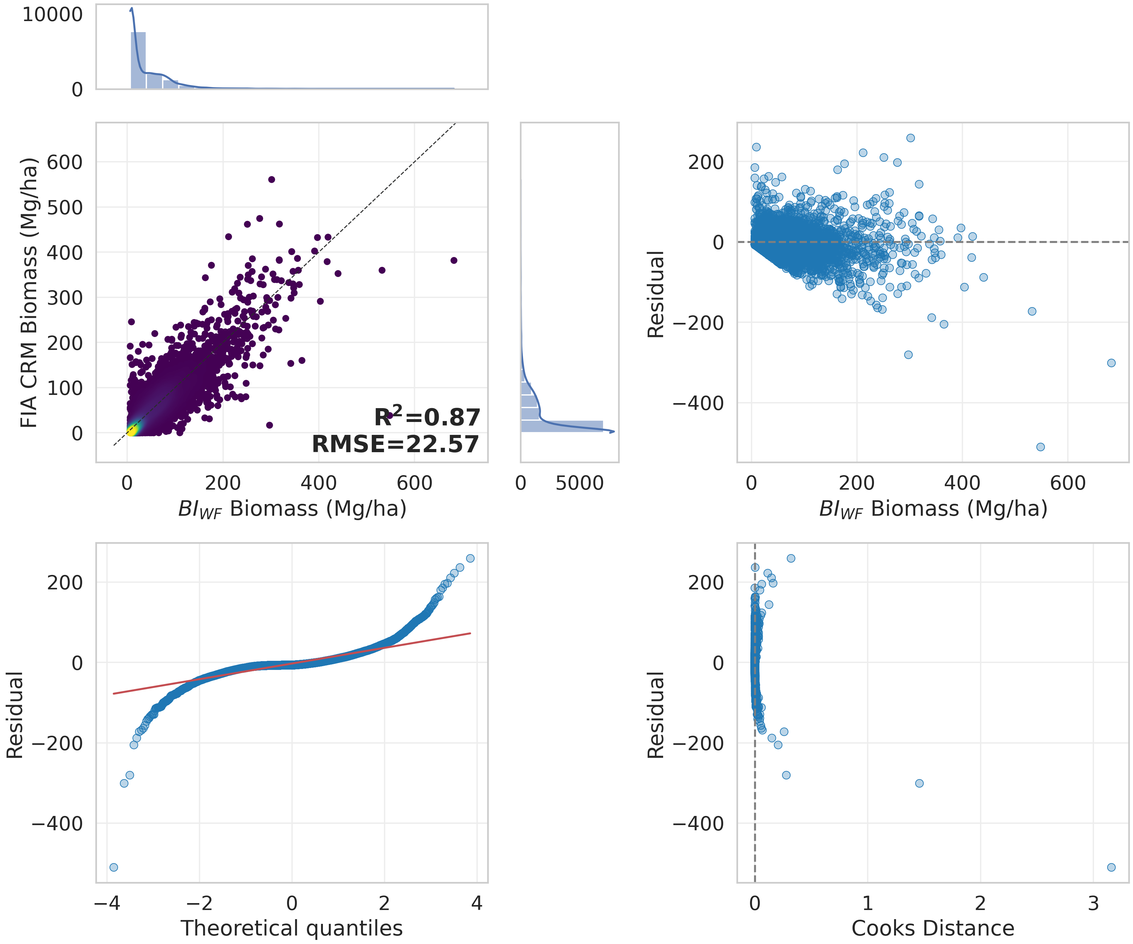
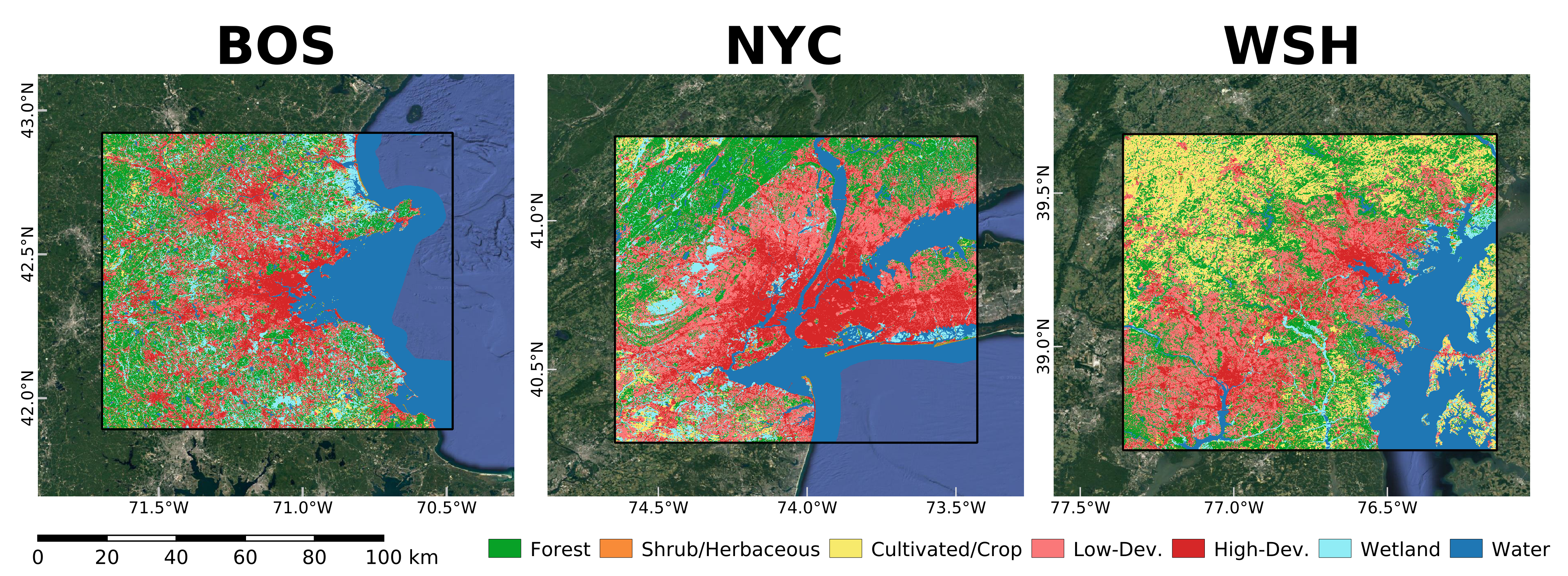
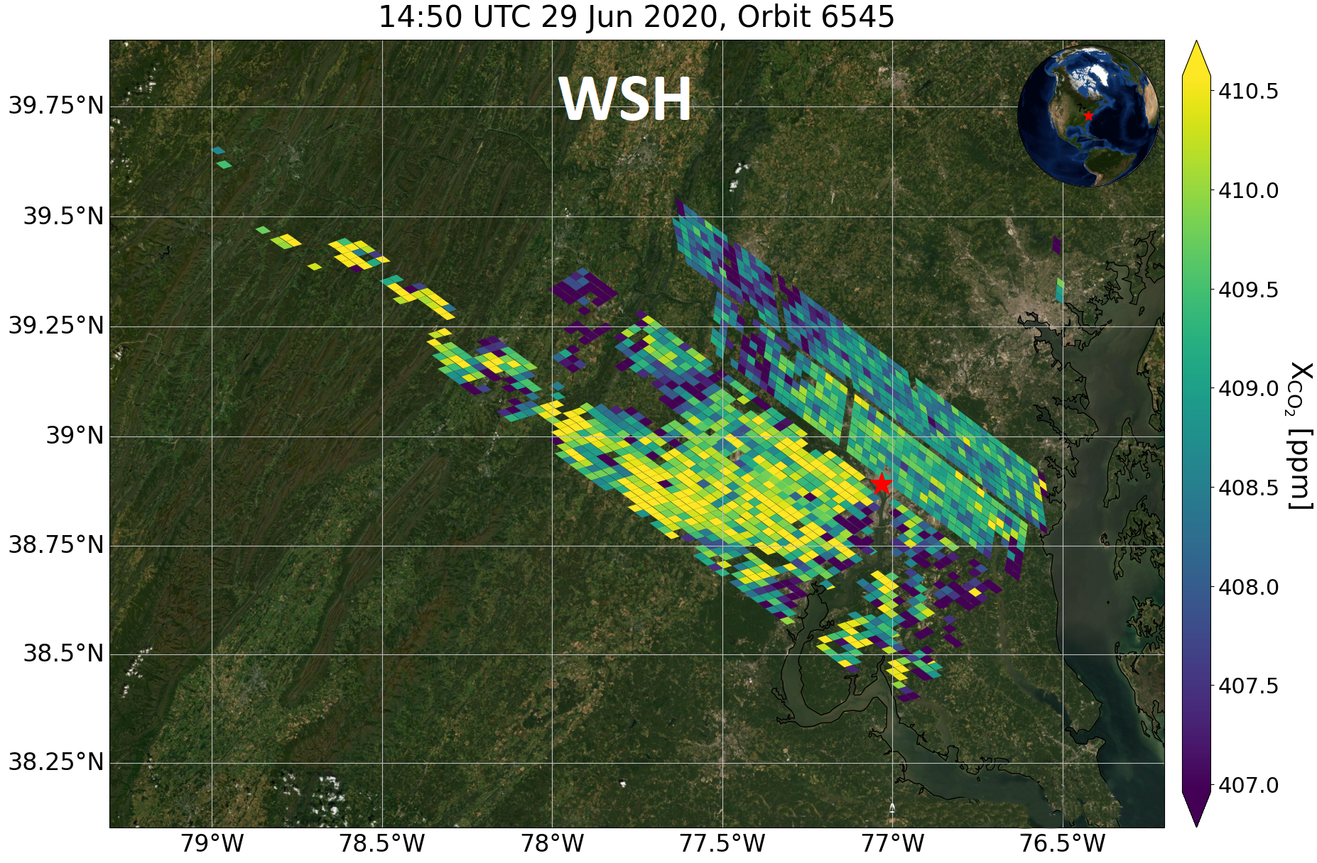
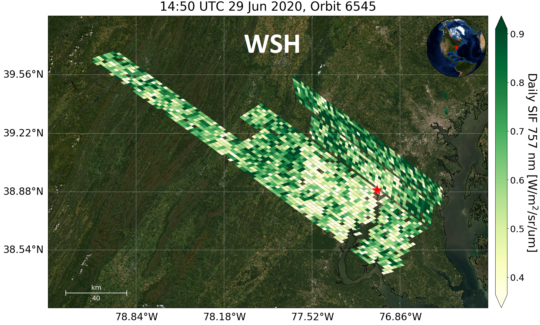
My recent work involves using airborne and satellite remote
sensing data to derive various forest structural parameters and
quantities, such as above ground biomass, foliage clumping, canopy
albedo, and vertical foliage profiles. Specifically, this work
contributes to the ability to predict terrestrial carbon storage
and fluxes in response to anthropogenic and natural environmental
change.
Education:
• 2022 M.S. in Geoinformatics. CUNY Hunter College,
New York
Open-source Packages/Apps:
• Python Packages:
neonutilities